Capitol Reef National Park United States

Enjoy the colorful canyons, ridges, buttes, and monoliths that reside in the park's desert landscape.
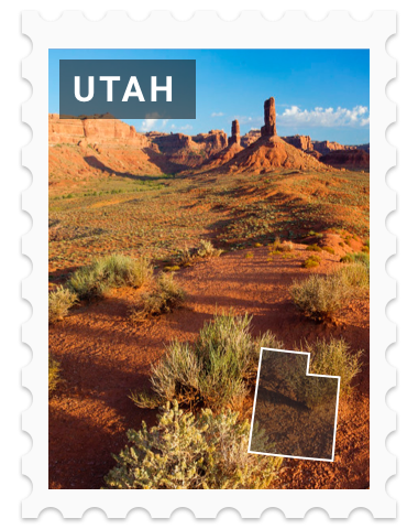
Photo by Wolfgang Staudt
Kid Rating:
Capitol Reef National Park is in south-central Utah. The park is approximately 60 miles (97 km) long on its north–south axis and just 6 miles (9.7 km) wide on average. The park was established in 1971 to preserve 241,904 acres (377.98 sq mi; 97,895.08 ha; 978.95 km2) of desert landscape and is open all year, with May through September being the highest visitation months.
Partially in Wayne County, Utah, the area was originally named "Wayne Wonderland" in the 1920s by local boosters Ephraim P. Pectol and Joseph S. Hickman. Capitol Reef National Park was designated a national monument on August 2, 1937, by President Franklin D. Roosevelt to protect the area's colorful canyons, ridges, buttes, and monoliths; however, it was not until 1950 that the area officially opened to the public. Road access was improved in 1962 with the construction of State Route 24 through the Fremont River Canyon.
The majority of the nearly 100 mi (160 km) long up-thrust formation called the Waterpocket Fold—a rocky spine extending from Thousand Lake Mountain to Lake Powell—is preserved within the park. Capitol Reef is an especially rugged and spectacular segment of the Waterpocket Fold by the Fremont River. The park was named for its whitish Navajo Sandstone cliffs with dome formations—similar to the white domes often placed on capitol buildings—that run from the Fremont River to Pleasant Creek on the Waterpocket Fold. Locally, reef refers to any rocky barrier to land travel, just as ocean reefs are barriers to sea travel.


XP EARNED OUT OF 0
Points Earned
| Stamp | 0 XP |
| Trivia Questions | 0 XP |
| Quests | 0 XP |
| Trading Card | 0 XP |
| Total | 0 XP |
Become Legendary
Complete these quests to earn your legendary status.
Hike the 0.8-mile round trip trail out to Sunset Point.
Stop and enjoy the beautiful views of the park from Panorama Point.
Take in the views as you drive Highway 24 that runs through the center of the park.
Explore the ancient art carved into the rocks by the Fremont and Ancestral Puebloan people.
For a more moderate hike, journey out to see the natural bridge on the Hickman Bridge Trail.
Spot Pectols Pyramid, a 180 million year old natural rock formation in the shape of a pyramid.
If you have a 4x4 vehicle, adventure out on the rugged 3 hour drive to the Temple of the Sun and Moon.
Make the short hike to Goosenecks Overlook, a rock formation carved into the red rock canyon by the creek below.
Learn about the Mormon settlers that inhabited the area by exploring the Fruita Schoolhouse, Blacksmith Shop, and other buildings.
Hike the 1.5-mile trail to the Pioneer Register, an area of the park where settlers, over 100 years ago, carved their names into the sandstone on their journey.
Login to customize your picture from Capitol Reef National Park.

Exploring Utah